Geospatial Drone Solutions

Drone LiDAR Surveying in St. Louis & St. Charles County

Survey-grade LiDAR mapping across Missouri and Southern Illinois. TerraSight captures, classifies, and delivers dense point cloud data your engineers can open in Civil 3D or ArcGIS the same day it arrives.

What You Receive

LiDAR Data Built for Engineering Decisions

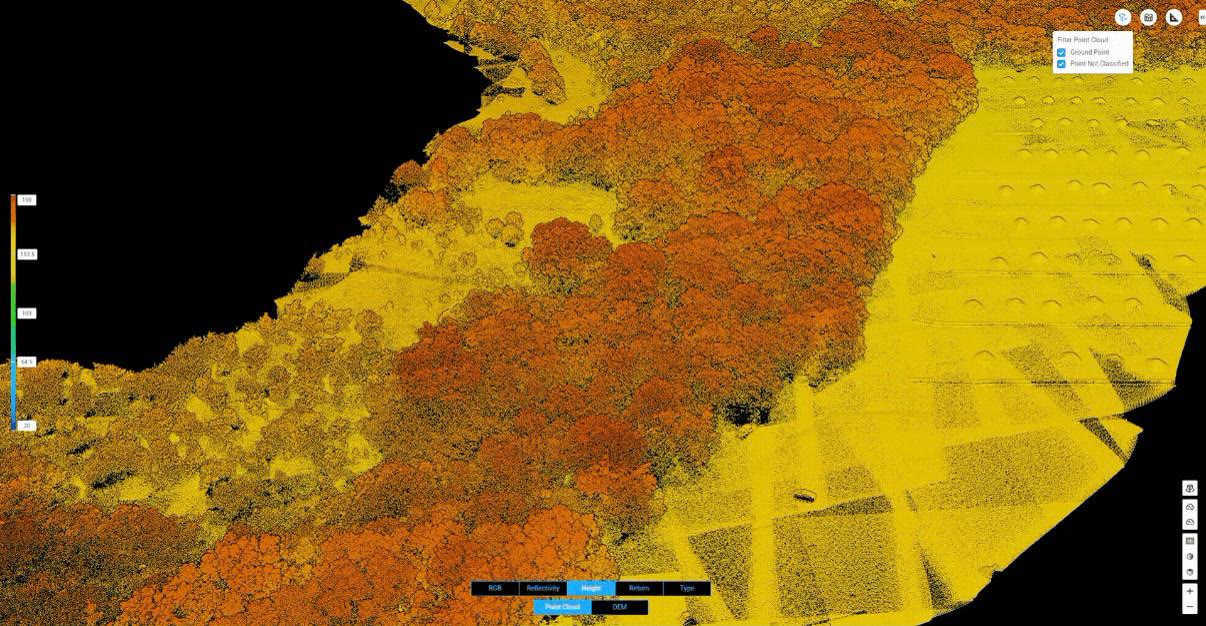
A drone LiDAR survey from TerraSight is a data product, not a flight. Our DJI L-series LiDAR payload emits up to 240,000 laser pulses per second and records multiple returns from each, producing a georeferenced point cloud that describes terrain, vegetation, structures, and utilities in three dimensions. That raw cloud is then classified, filtered, validated against ground control, and refined into the specific deliverables your project calls for.

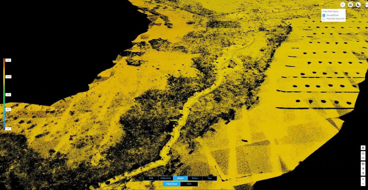
Because LiDAR measures distance directly rather than inferring it from photographs, it captures the bare ground beneath tree canopy, brush, and tall grass. That makes it the right tool for wooded parcels, creek corridors, utility rights-of-way, and any St. Louis-area site where photogrammetry would only model the top of the vegetation.

Every dataset is delivered in the coordinate system your project requires, most often Missouri East or Illinois West State Plane, with vertical datums documented in the accompanying accuracy report. If your team also needs contour sheets or a design surface, see our topographic mapping and contour service.

Standard Deliverables
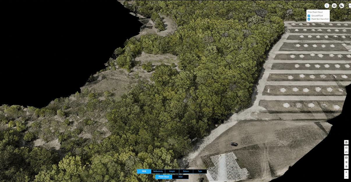
Classified Point Cloud (.LAS / .LAZ) Digital Terrain Model (DTM) Digital Surface Model (DSM) Digital Elevation Model (GeoTIFF) Contour Lines (DWG / SHP) Cross-Section Profiles Intensity & Hillshade Rasters Colorized RGB Point Cloud Accuracy & QC Report
Sensor Specifications
SensorDJI L-Series LiDAR
Point RateUp to 240,000 pts/sec
ReturnsMulti-Return (3 Returns)
Vertical Accuracy±3 cm
Horizontal Accuracy±5 cm
PositioningRTK / PPK GNSS
Compatible WithAutoCAD, Civil 3D, ArcGIS, QGIS
Who It Serves

LiDAR Mapping for Missouri & Illinois Project Teams

Drone LiDAR fills the gap between a conventional ground survey and a full manned-aircraft acquisition: dense enough for design, fast enough for weekly site updates, and priced for parcels from a few acres to several square miles.

Civil Engineers & Site Designers

Existing-conditions surfaces for grading, drainage, and roadway design. Import the DTM directly into Civil 3D as a TIN surface and begin design the same day.

Land Surveyors

High-density topographic data to supplement conventional field work on large, wooded, or hazardous parcels. We deliver in your control and coordinate system.

Developers & Land Planners

Terrain intelligence for due diligence in St. Charles County and the growing I-64 and I-70 corridors before committing to engineering spend.

Utilities & Corridor Owners

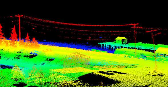
Transmission line, pipeline, and rail corridor mapping with vegetation encroachment and clearance measurements from the classified point cloud.

Mining & Aggregate Operations

Pit and quarry surfaces, haul road profiles, and stockpile inventories across the limestone and sand operations of eastern Missouri and Southern Illinois.

Environmental & Water Resources

Bare-earth terrain for floodplain studies, stream restoration, stormwater modeling, and watershed analysis along the Missouri, Mississippi, and Meramec river systems.

How It Works

Capture. Process. Deliver.

Every LiDAR project moves through a defined workflow so that accuracy is designed in from the start, not checked at the end.

01
Scoping & Flight Planning

We define the project boundary, required point density, coordinate system, and deliverable list with you. Flight lines, altitude, and overlap are planned in mission software to hit the density target across the entire site, including steep slopes and tree-covered areas.

02
Ground Control & Checkpoints

Where accuracy requirements call for it, we establish ground control points and independent checkpoints using GNSS survey equipment. Control is tied to published Missouri or Illinois control, or to your surveyor's existing project control.

03
LiDAR Data Capture

An FAA Part 107 licensed, professionally trained pilot flies the mission with RTK or PPK positioning engaged. LiDAR, IMU, GNSS, and RGB imagery are logged together so that every return is time-stamped and georeferenced.

04
Processing, Classification & QC

Trajectories are post-processed, strips are aligned, and the point cloud is classified into ground, vegetation, buildings, and other classes. We compare the surface to checkpoints, document residuals, and generate the DTM, DSM, contours, and sections.

05
Delivery & Support

Deliverables arrive digitally in the formats you specified, with an accuracy report and metadata. We remain available to help your engineering or GIS staff load, interpret, and integrate the data.

Why TerraSight

A Local LiDAR Team That Understands the Deliverable

TerraSight is based in O'Fallon, Missouri, which puts most St. Louis metro, St. Charles County, and Metro East sites within a short drive. Scheduling is direct, re-flights are practical, and we can coordinate on site with your surveyor or project manager.

More important than proximity is what happens after the flight. We process every dataset in professional geospatial software, classify it with care, and verify it against control before anything leaves our hands. The point cloud you receive is ready to use, not a raw export you need to clean up.

Our processing stack and sensor specifications are published on the technology page, and representative outputs are shown on our projects page. If a project is better served by photogrammetry instead of LiDAR, we will tell you, and we can deliver orthomosaics and photogrammetric models as part of the same engagement.

  • FAA Part 107 licensed pilots and full commercial insurance coverage
  • Multi-return LiDAR that models true ground beneath vegetation
  • RTK/PPK positioning with ground control and independent checkpoints
  • Classified point clouds, not unfiltered raw scans
  • Deliverables in Missouri and Illinois State Plane or your project datum
  • Native compatibility with AutoCAD, Civil 3D, ArcGIS, and QGIS
  • Documented accuracy report with every dataset
Questions

Drone LiDAR Survey FAQ

How accurate is a drone LiDAR survey?

TerraSight's DJI L-series LiDAR systems are rated for ±3 cm vertical and ±5 cm horizontal accuracy. Final project accuracy depends on flight parameters, ground control, and site conditions, so every deliverable package includes an accuracy report that documents how the dataset was validated.

Can drone LiDAR map ground beneath trees and brush?

Yes. Multi-return LiDAR records several reflections per laser pulse, allowing returns that pass through gaps in the canopy to reach the ground. After classification, those ground returns produce a bare-earth terrain model that photogrammetry cannot generate in wooded or brush-covered areas.

What file formats do you deliver for LiDAR data?

Standard deliverables include classified LAS or LAZ point clouds, GeoTIFF DEM/DTM/DSM rasters, contour lines as DWG/DXF or Shapefile, and cross-sections. All files are delivered in the coordinate system your project requires, typically Missouri or Illinois State Plane, and open directly in AutoCAD, Civil 3D, ArcGIS, and QGIS.

Is drone LiDAR a replacement for a licensed land survey?

No. TerraSight provides geospatial data collection and processing, not boundary or legal surveys. Our data is routinely used by licensed surveyors and engineers as a high-density source for topographic work, design, and analysis. Where a sealed survey is required, we work alongside your surveyor of record.

Where in the St. Louis region do you provide LiDAR surveying?

TerraSight is based in O'Fallon, Missouri and serves the entire St. Louis metro, St. Charles County, and Southern Illinois, including the Metro East. We also take on projects elsewhere in Missouri and Illinois by arrangement.

Related Services

Pair LiDAR With the Right Deliverable

Planning a LiDAR Survey in the St. Louis Area?
Send us the site boundary and your deliverable requirements. We will respond with a scoped proposal.
Request a Consultation