Photogrammetry for Missouri and Southern Illinois: centimeter-resolution orthomosaics, surface models, and textured 3D meshes, georeferenced and ready for ArcGIS, AutoCAD, and Civil 3D.
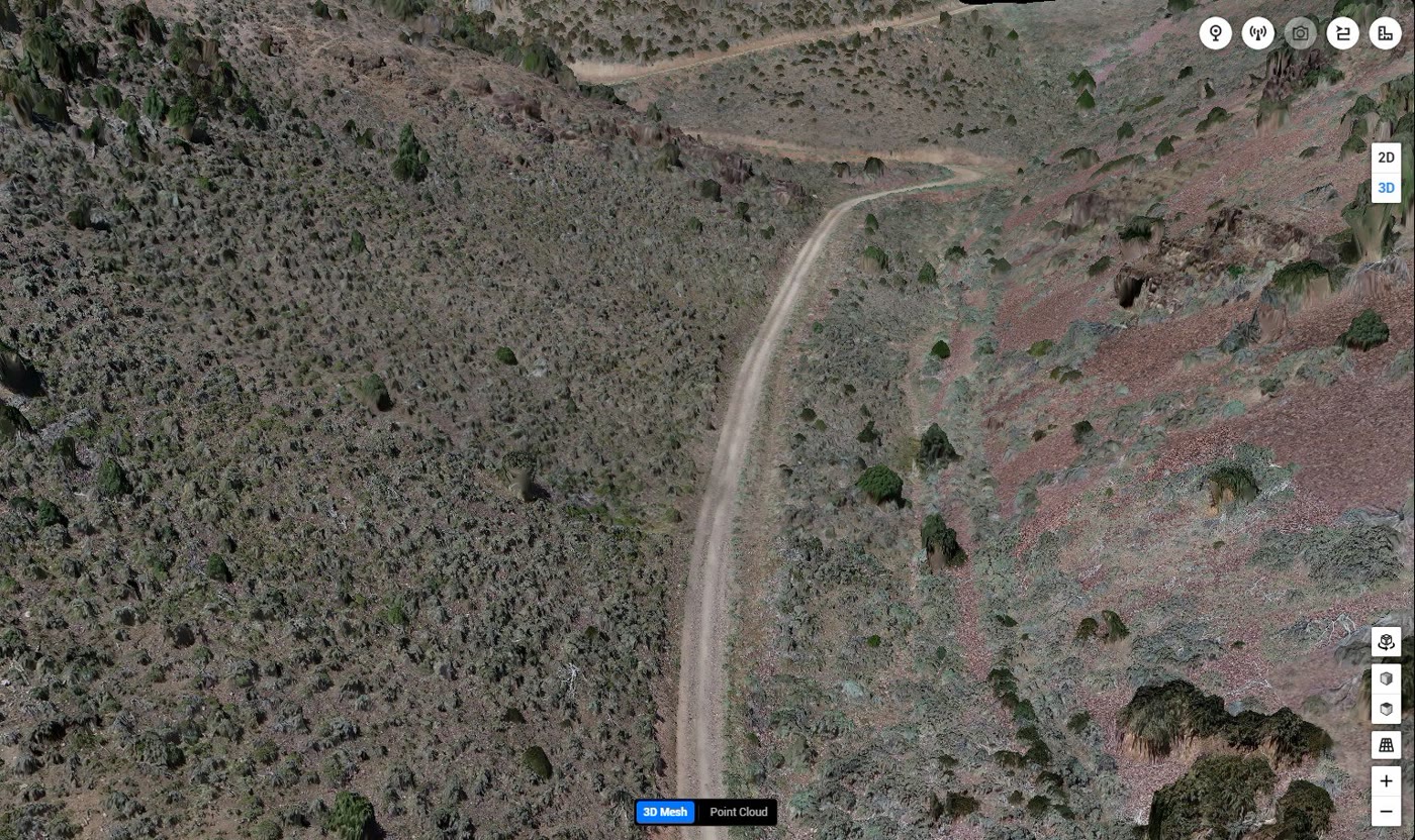
Photogrammetry reconstructs geometry from overlapping photographs. TerraSight flies a planned grid over the site, capturing hundreds to thousands of high-resolution images with precise GNSS positions, and processes them in professional photogrammetry software into a georeferenced orthomosaic, a digital surface model, a dense point cloud, and, where required, a textured 3D mesh.
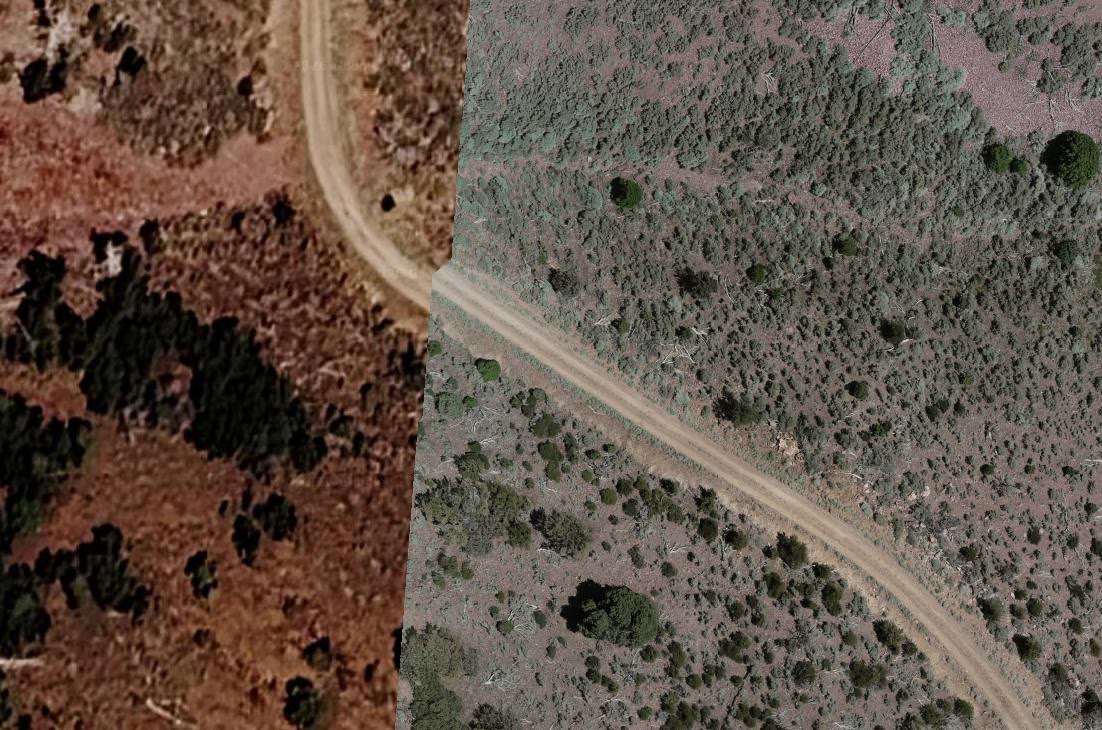
The orthomosaic is the product most clients use daily. It is a single seamless image of the entire site, corrected for lens and terrain distortion so that distances, areas, and positions measured on it are true. At a ground sample distance of a few centimeters per pixel, it shows detail that satellite and county aerial imagery cannot: curb lines, stakes, pavement condition, erosion, and stockpile toes.
Because every image carries an accurate position, the same dataset supports volume calculations, cut/fill comparisons between flights, and as-built checks against design. For vegetated or wooded sites where a true ground surface matters, we recommend pairing photogrammetry with our drone LiDAR surveying service.
| Camera | Integrated 20 MP RGB |
| Resolution | Centimeter-level ground sample distance |
| Positioning | RTK / PPK GNSS + Ground Control |
| Processing | Pix4D / Metashape / DJI Terra |
| Coordinate Systems | MO / IL State Plane or project datum |
| Compatible With | ArcGIS, QGIS, AutoCAD, Civil 3D |
Anyone who needs to see, measure, and document a site without walking every foot of it. Photogrammetry fits a wide range of St. Louis-area work, from a single commercial lot to multi-square-mile land holdings.
Recurring progress orthomosaics and 3D models for schedule verification, pay applications, and owner reporting on commercial and industrial sites.
Current base imagery, surface models, and planimetric detail for design, as-built comparison, and exhibit preparation.
High-resolution site imagery for due diligence, marketing, site plans, and entitlement submittals across St. Charles County and the metro.
Stockpile volumes, pit progression, and haul road condition from repeat flights, with change detection between datasets.
Fresh orthoimagery for parks, infrastructure projects, and parcel updates when county-wide flights are out of date.
Field-scale orthomosaics and surface models for drainage planning, stand assessment, and documentation of Missouri and Illinois farmland.
Photogrammetry rewards careful planning. Overlap, altitude, lighting, and control all determine whether the output is a pretty picture or a measurable map.
We confirm the area of interest, the ground sample distance you need, the coordinate system, and the deliverable list. The mission is planned with the overlap and altitude required to reconstruct the site reliably, including oblique passes for 3D models of structures.
Ground control points are placed and surveyed with GNSS equipment where the project's accuracy requires them. Independent checkpoints are withheld from processing so that reported accuracy is a measurement, not an estimate.
An FAA Part 107 licensed, professionally trained pilot flies the mission with RTK/PPK positioning. Flights are timed for consistent lighting and minimal shadow, and image quality is reviewed on site before the crew leaves.
Images are aligned, tied to control, and densified into a point cloud. The orthomosaic, surface model, and mesh are generated, then checked for seams, distortion, and residuals against checkpoints before any derivative products are produced.
Deliverables are exported in your formats and coordinate system with an accuracy report. For recurring programs, each new dataset is aligned to the baseline so progress and volume comparisons are consistent flight to flight.
Consumer drones can produce an orthomosaic. What they rarely produce is one you can measure from with confidence. TerraSight applies the same control, positioning, and quality review to photogrammetry that we apply to LiDAR: RTK/PPK positioning, surveyed ground control, withheld checkpoints, and a written accuracy statement with every delivery.
We also understand what the data is for. Orthomosaics are delivered in the projection your GIS or CAD already uses, point clouds are cleaned, and meshes are decimated to sizes that open without crashing a workstation. When a job calls for a different tool, such as LiDAR for a wooded tract or thermal imaging for a roof or array, we say so.
TerraSight operates from O'Fallon, Missouri and covers the St. Louis metro, St. Charles County, and Southern Illinois as local territory, which keeps repeat progress flights practical. Our processing stack is described on the technology page, and sample work is shown on the projects page. For contour and terrain deliverables from the same flight, see topographic mapping and contours.
An orthomosaic is a single, seamless aerial image assembled from hundreds or thousands of overlapping drone photos, each corrected for lens distortion and terrain relief so that scale is uniform and measurements are true. Drone orthomosaics are captured at a few centimeters per pixel, while typical commercial satellite imagery is 30 to 50 cm per pixel and often months old. The difference is visible immediately: individual pavement cracks, survey stakes, and stockpile edges are legible in a drone orthomosaic.
With RTK/PPK positioning and ground control points, photogrammetric outputs can reach horizontal accuracy on the order of a few centimeters and vertical accuracy within several centimeters on open, well-textured ground. Accuracy degrades on vegetation, water, and uniform surfaces, which is why we use LiDAR for those conditions. Every project ships with an accuracy report that states the achieved values.
Yes. Orthomosaics are delivered as GeoTIFF for ArcGIS, QGIS, and Civil 3D; point clouds as LAS or LAZ; surface models as GeoTIFF rasters; and 3D meshes as OBJ, FBX, or PLY. All files are georeferenced in your project coordinate system, typically Missouri or Illinois State Plane.
Photogrammetry is the right choice when you need a high-resolution visual record, when the site is open and hard-surfaced, or when a textured 3D model matters, as with construction progress, stockpile inventory, and facility documentation. LiDAR is the right choice for wooded or brushy terrain, corridor mapping, and bare-earth modeling. Many projects benefit from both, captured on the same visit.
TerraSight is based in O'Fallon, Missouri and provides photogrammetry and orthomosaic mapping throughout the St. Louis metro, St. Charles County, and Southern Illinois, including the Metro East. Projects elsewhere in Missouri and Illinois can be scheduled by arrangement.