Geospatial Drone Solutions

Stockpile Volume Measurement in St. Louis

Drone-surveyed stockpile volumes, earthwork cut-fill quantities, and inventory reports for quarries, contractors, landfills, and terminals across the St. Louis metro, St. Charles County, and Southern Illinois.

What You Receive

Volumes You Can Defend at Month-End

A stockpile volume is only as good as the two surfaces that define it: the top of the material and the base it sits on. A GPS rover walked around the toe and over the crest captures a few dozen points and interpolates the rest. A drone survey captures the exposed surface with thousands of measured points per pile, including the irregular faces, loader cuts, and conveyor cones that a sparse survey smooths away. The result is a volume that reflects what is actually on the ground.

TerraSight flies each yard with DJI L-series LiDAR or high-overlap photogrammetry tied to RTK/PPK positioning and ground control. Each pile is delineated, assigned a base surface, and computed as a bounded solid. The report lists volume, base method, surface area, and the material designation you use internally, with pile boundaries drawn on an orthomosaic so there is no ambiguity about what was measured.

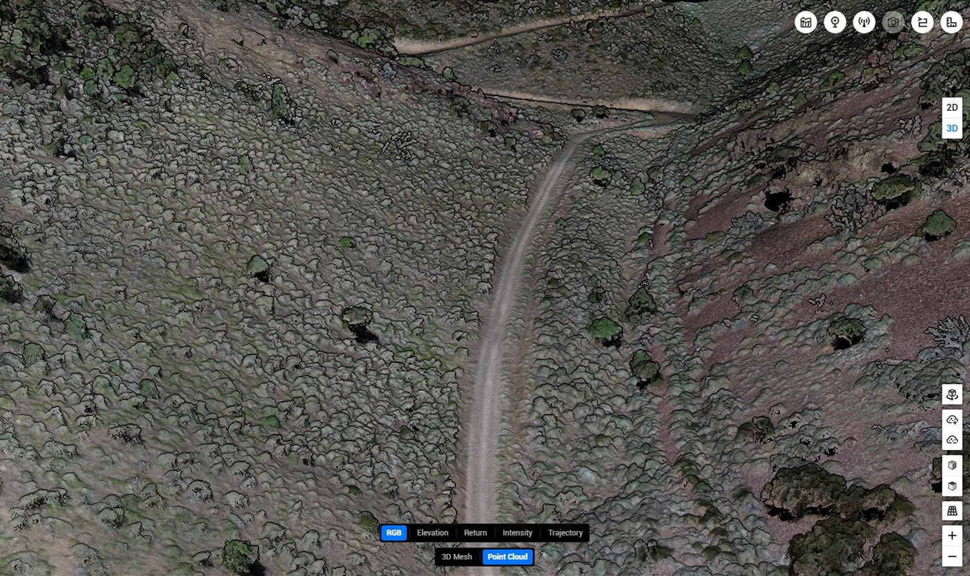
Beyond the summary report, you receive the surfaces themselves. The top-of-pile and base surfaces, DEM, point cloud, and orthomosaic are delivered in formats that open directly in Civil 3D, AutoCAD, and ArcGIS, so your engineers or inventory accountants can recompute, audit, or combine them with their own data. The technology page describes the sensors and processing software behind every dataset.

Standard Deliverables
Volumetric Report (PDF / XLSX) Pile-by-Pile Volume Table Top & Base Surfaces (DWG / LandXML) Cut-Fill Analysis & Heat Map Classified Point Cloud (LAS / LAZ) Digital Elevation Model (GeoTIFF) Georeferenced Orthomosaic Pile Boundary Shapefile / KMZ Accuracy & Methodology Statement
Survey Parameters
Capture MethodLiDAR or Photogrammetry
PositioningRTK / PPK with Ground Control
Volume UnitsCubic Yards or Cubic Meters
Base OptionsSurveyed Pad, Prior Survey, Triangulated Toe
Compatible WithCivil 3D, AutoCAD, ArcGIS, Excel
Applications

Four Ways We Measure Material

Stockpiles, excavations, fills, and cells all reduce to the same question: how much material is between two surfaces? Each application has its own conventions for answering it.

Stockpile Inventory & Reconciliation

Aggregate yards, asphalt and ready-mix plants, scrap and recycling facilities, and bulk terminals carry material inventory on the balance sheet. A drone stockpile survey measures every pile in the yard in a single visit, with each product delineated and reported separately so the volumes can be reconciled against scale tickets and production records.

Recurring surveys on a fixed interval use the same ground control and pile definitions, giving finance and operations teams period-over-period comparisons that are consistent in method.

Earthwork Cut-Fill Quantities

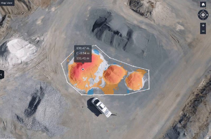
Comparing a surveyed existing-ground surface against a design surface or a prior survey produces cut and fill volumes across the whole site, not just along cross-sections. We deliver the comparison as a color-coded heat map, a quantity table by zone, and the surfaces themselves for import into Civil 3D.

The same approach documents borrow pit extraction, embankment placement, and mass haul progress for pay application support.

Landfill Airspace & Fill Progress

Landfill operators track consumed airspace, remaining capacity, and compaction density by comparing periodic surface surveys against the permitted final grade and the base liner. Drone capture covers the active face and intermediate cover without putting survey crews on the working surface.

Deliverables include the surveyed surface, airspace consumed since the prior survey, and remaining capacity against the permit design.

Commodity & Bulk Material Piles

Grain on outdoor ground piles, fertilizer and salt under partial cover, coal and petroleum coke at terminals, and woodchip or biomass stockpiles all present irregular surfaces that are difficult and sometimes unsafe to walk. Oblique imagery and LiDAR returns capture material against bunker walls and tarps.

Where you supply a bulk density, the report includes a tonnage estimate alongside the measured volume with the conversion factor stated.

Who It Serves

Operations That Carry Material on the Books

Aggregates & Quarries

Product inventory surveys for crushed stone, sand, and gravel operations across eastern Missouri and Southern Illinois, with pile-by-pile reporting by product code.

Mining & Extraction

Run-of-mine, ore, waste rock, and tailings volumes for pit progress, reserve reconciliation, and reclamation bond estimates.

Construction & Earthwork Contractors

Cut-fill quantities, borrow and spoil tracking, and progress volumes to support estimates, change orders, and pay applications.

Landfills & Waste Facilities

Airspace consumption, remaining capacity, and cover thickness surveys without crews on the active face.

Agriculture & Commodity Handlers

Ground pile and bunker measurements for grain elevators, fertilizer dealers, and cooperatives during harvest and storage season.

Logistics Yards & Bulk Terminals

Coal, coke, salt, scrap, and aggregate inventory at river terminals, rail yards, and distribution sites throughout the St. Louis region.

How It Works

Capture. Process. Deliver.

Consistent volumes come from consistent method. Every stockpile survey follows the same controlled sequence, whether it is a single pile or a forty-product yard.

01
Yard Review & Pile Definitions

We review the site layout, product list, containment structures, and how your team wants volumes reported. Pile naming, base surface method, and units are agreed before the first flight so the report matches your inventory system.

02
Ground Control & Base Survey

Ground control points are set using survey GNSS equipment and, where practical, made permanent for repeat visits. If a pad can be surveyed clean, we capture it to establish a true base surface that every future measurement references.

03
LiDAR or Photogrammetry Capture

An FAA Part 107 licensed, professionally trained pilot flies the yard with DJI Enterprise systems. Steep faces and material against walls are captured with oblique passes. Flights are scheduled around loader activity so piles are not moving while they are measured.

04
Surface Modeling & Volume Computation

The point cloud is classified to remove equipment, vehicles, and vegetation, then checked against ground control. Each pile is delineated at the toe, bounded by its base surface, and computed as a solid. Volumes are cross-checked in a second software package before release.

05
Report & Data Handoff

You receive the volumetric report, the pile table, the surfaces, point cloud, DEM, and orthomosaic, together with a methodology statement describing control, base surfaces, and residuals. Datasets are retained so the next survey is processed on identical terms.

Why TerraSight

Measurement, Not Estimation

Many drone volume services return a number with no stated basis. TerraSight reports the base surface used for every pile, the control residuals, and the method, so the volume can be audited by your engineer, your accountant, or a third party. If a pile sits against a wall or on a sloped pad, the report says so and shows how it was handled.

We are based in O'Fallon, Missouri, which keeps month-end and quarter-end inventory flights across the St. Louis metro and Metro East practical to schedule around production. Our pilots are FAA Part 107 licensed and professionally trained in survey-grade data collection, and our operations are fully insured for work on active industrial sites.

Volumetric surveys often share a site visit with topographic mapping for pit or site design and with construction progress monitoring on earthwork projects. Sensor and software specifications are on the technology page, and sample datasets are on the projects page.

  • Thousands of surface points per pile instead of a walked toe-and-crest line
  • Base surface method documented for every pile in the report
  • Oblique capture resolves material against walls, bins, and bunkers
  • Permanent control for repeat surveys that compare period to period
  • Volumes cross-checked in a second software package before release
  • Surfaces delivered for Civil 3D, AutoCAD, and ArcGIS, not just a PDF
  • No survey crews climbing piles or working the active face
  • FAA Part 107 licensed pilots, fully insured operations
Questions

Stockpile Volume Measurement FAQ

How accurate is a drone stockpile volume measurement?

Volume accuracy depends on how well the pile surface and the base beneath it are defined. Drone LiDAR and photogrammetry capture the exposed surface with thousands of measured points per pile rather than the handful a GPS rover collects, which typically reduces surface error well below conventional methods. The base surface is the larger variable, so we document which base was used for every pile and recommend a clean-pad or pre-stockpile survey to establish it where possible. Each report states its basis so your accounting or engineering team can judge it on its own terms.

Do you measure in cubic yards or tons?

We measure and report volume in cubic yards or cubic meters. If you provide a density or conversion factor for each material, the report will include a tonnage estimate alongside the volume with the factor clearly noted. We do not determine material density ourselves.

Can drone data capture piles against walls, bins, or bunkers?

Yes. Oblique imagery and LiDAR returns resolve material against retaining walls, in concrete bins, and under partial cover far better than nadir-only photography. We model the containment geometry so the volume is bounded by the actual wall and floor surfaces rather than an assumed footprint.

How does a recurring inventory program work?

We establish permanent ground control and a consistent base surface on the first visit, then fly the yard on the interval you set, such as monthly or at each quarter-end. Every survey is processed against the same control and the same pile definitions, so the volumes are directly comparable from period to period and the reports can go straight to inventory reconciliation.

Where do you provide drone stockpile surveys?

TerraSight is based in O'Fallon, Missouri and provides drone stockpile and volumetric surveys throughout the St. Louis metro, St. Charles County, and Southern Illinois, including the Metro East. Multi-site quarry and terminal programs elsewhere in Missouri and Illinois can be scheduled by arrangement.

Related Services

More From the Same Site Visit

Need Stockpile Volumes in the St. Louis Area?
Tell us about the yard, the materials, and how you report inventory. We will recommend a survey method and interval.
Request a Consultation